


.jpg)
A Fundamentally Better Approach to Integration
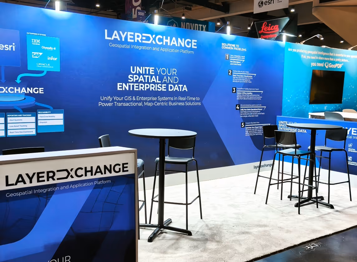
LayerExchange provides a complete platform, combining no-code speed with low-code power, purpose-built to solve your most complex spatial integration challenges. Our architecture enables you to configure, deploy, and manage robust, map-centric applications that weave together your Esri GIS with critical enterprise systems.
The result is a single, unified operational view. You can now build the powerful solutions you need — from real-time situational awareness dashboards to deeply integrated applications powered by a true, two-way synchronization between your Esri GIS and core enterprise systems — all on a scalable platform your own team can manage and extend.
Unlike traditional development that forces you to start from scratch on each project, LayerExchange provides the robust backend infrastructure you need out-of-the-box. We supply the pre-built components for security, data management, and workflow engines, so your team can stop reinventing core infrastructure and focus on delivering value. Furthermore, the platform establishes a comprehensive REST API, ensuring future technology investments can be integrated easily, preventing technical debt.
At the platform's core is a guarantee of data integrity. LayerExchange facilitates a constant, two-way data flow to ensure consistency across all connected systems. Critically, it allows you to flexibly define which system — be it GIS or an enterprise application — is the authoritative "source of truth" for any piece of data. This intelligent synchronization respects your business rules, builds unwavering trust in your data, and eliminates the costly errors caused by inconsistent information.
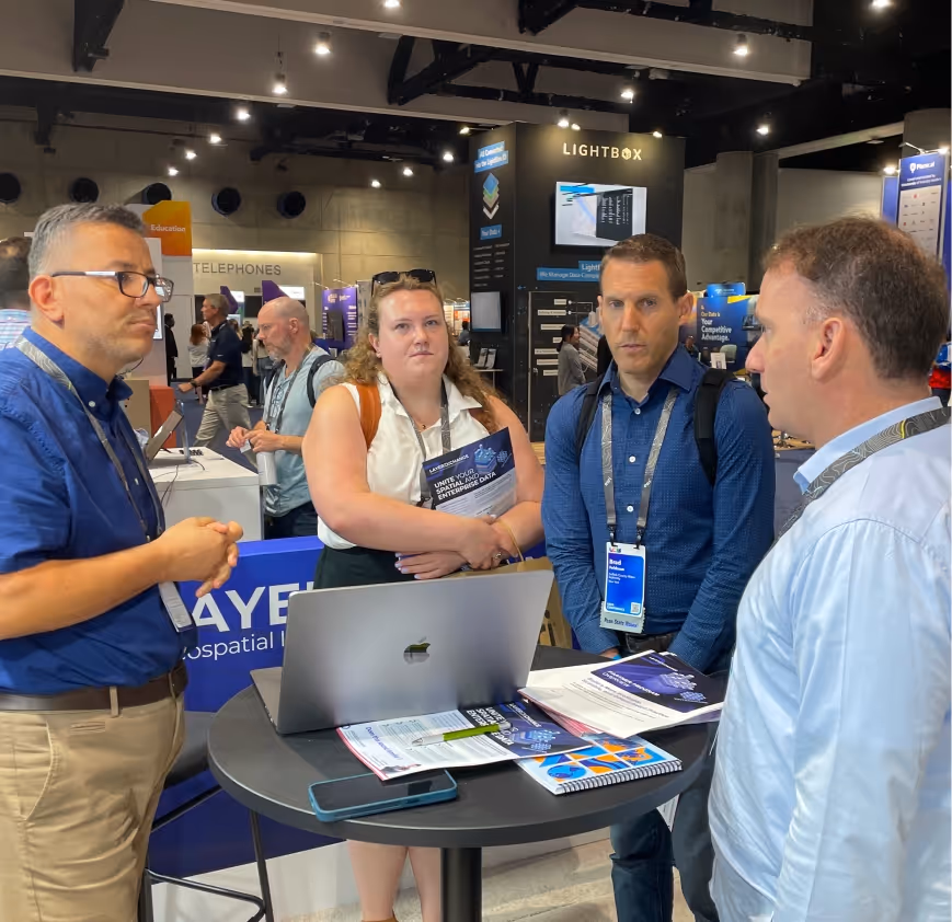
Expanding Our Network at ESRI UC 2025
Our team attended the ESRI User Conference 2025 in San Diego (June 14-17), where we engaged with prospective clients and strategic partners.


Usual Challenges
Does your GIS show you where your assets are, while your enterprise systems tell you what they're doing—but the two worlds never meet?
If so, your teams are likely struggling with the consequences: field crews juggling disconnected map and work order apps , operational blind spots because enterprise data isn't on your map , and a powerful Esri platform whose potential remains locked away.This critical integration gap isn't just frustrating—it's actively hindering your ability to make truly informed decisions and respond effectively when it matters most.
The GIS-Enterprise Gap
Your Esri platform holds the authoritative 'where,' but your enterprise systems (EAM, ERP, SCADA) hold the 'what'—and they operate in separate worlds.
Costly, Brittle Integrations
Relying on custom-coded, one-off connectors that are expensive to build, impossible to scale, and break with every software update.
Failed Field Mobility
Being told your field apps can't have fully-functional offline maps and deep, two-way integration with your back-office enterprise systems.
No Real-Time Map Awareness
Inability to see live asset status, work orders, or IoT data from your enterprise systems directly on your operational maps, forcing you to make decisions with an incomplete picture.
Inability to Say "Yes"
Lacking the platform to confidently take on complex projects that require weaving together spatial and non-spatial data, limiting your strategic value.
Constant Maintenance Headaches:
The high cost and complexity of maintaining custom code and the reliance on specialized developers who understand both GIS and enterprise platforms.
Key Features


By providing two-way automatic data integration between Geographical Information Systems and Management Information Systems, it aims to keep the information in both systems always relevant and up-to-date. This two-way integration eliminates the need for manual operations, minimizes human error during data entry, and increases efficiency in processes. As a result, operational costs are reduced and decision-making processes are accelerated and improved.
Automation
Data Compatibility
Increased Efficiency

Our platform can effectively manage QA/QC processes during end-to-end data integration. For example, asset data in ArcGIS is updated by matching asset data from ArcGIS with the appropriate identity data. This update is completed by creating a work order in the MIS and storing the relevant personnel information. However, since this process is performed during the QA/QC phases, the updates are not applied to the master tables or systems until final approval is received. This allows you to maintain the accuracy and reliability of information at the highest level.
QA/QC Processes
Work Process
Quality Control

Our platform provides a proxy service to REST services in integrated systems, providing users with safe and fast access to these services. For example, symbology, field data, or tagging data stored in ArcGIS Server may be proxied through our platform and made available to users. In this way, users can use this information in their applications. Thus, we improve data security and access speed, while simplifying integration processes.
Simplified Integration
Enhanced Security

Our platform can effectively manage QA/QC processes during end-to-end data integration. For example, asset data in ArcGIS is updated by matching asset data from ArcGIS with the appropriate identity data. This update is completed by creating a work order in the MIS and storing the relevant personnel information. However, since this process is performed during the QA/QC phases, the updates are not applied to the master tables or systems until final approval is received. This allows you to maintain the accuracy and reliability of information at the highest level.
Three System Integration
Automatic Data Processing
Data Flow Between Systems

Our platform facilitates data flow between organizations by enabling data sharing and synchronization between different instances. This feature ensures that data is constantly updated and securely synchronized. In this way, organizations can quickly and efficiently share their data with each other without having to integrate it into a central system. This synchronization capability speeds up business processes and enhances cross-agency collaboration while making information sharing seamless.
Data Synchronization
Interagency Information Exchange

Our platform provides services that support WFS (Web Feature Service) standards, enabling users to visualize data in their applications. In this way, all clients that support WFS services such as ArcMAP, ArcGIS Pro, QGIS, OpenLayers, ArcGIS JS API can seamlessly integrate and use our data. Users can analyze, visualize and use the data they get from our platform in their map-based applications and projects. This flexibility makes it easier to share and integrate data, increasing efficiency in users' workflows.
WFS
Data Integration
Use Cases
Our platform delivers comprehensive integration solutions that bridge the gap between your geospatial systems and enterprise applications. These six core use cases enable seamless data synchronization, streamlined workflows, and enhanced decision-making across your organization. From automated two-way data integration to quality-controlled updates, secure service proxying, intelligent workflow management, cross-instance synchronization, and industry-standard visualization support, we've designed each feature to eliminate manual processes and transform how your teams collaborate with critical information.
Seamless Data Integration
By providing two-way automatic data integration between Geographical Information Systems and Management Information Systems, it aims to keep the information in both systems always relevant and up-to-date. This two-way integration eliminates the need for manual operations, minimizes human error during data entry, and increases efficiency in processes. As a result, operational costs are reduced and decision-making processes are accelerated and improved.
QA/QC Workflow Management
Our platform can effectively manage QA/QC processes during end-to-end data integration. For example, asset data in ArcGIS is updated by matching asset data from ArcGIS with the appropriate identity data. This update is completed by creating a work order in the MIS and storing the relevant personnel information. However, since this process is performed during the QA/QC phases, the updates are not applied to the master tables or systems until final approval is received. This allows you to maintain the accuracy and reliability of information at the highest level.
Secure Service Proxy
Our platform provides a proxy service to REST services in integrated systems, providing users with safe and fast access to these services. For example, symbology, field data, or tagging data stored in ArcGIS Server may be proxied through our platform and made available to users. In this way, users can use this information in their applications. Thus, we improve data security and access speed, while simplifying integration processes.
Automated Data Workflow
Our platform seamlessly integrates with various end systems and automatically receives and processes data from these systems. For the received data, a workflow is started on the platform within certain rules. This workflow is displayed on the user's screen, and users can check the information and make the necessary changes. When the verification process is completed, the processed data is securely transferred to another system with the user's approval. This process improves the efficiency of business processes by managing the flow of data between different systems in a seamless and reliable manner. Our platform thus enables users to efficiently manage and optimize their workflows.
Cross-Instance Synchronization
Our platform facilitates data flow between organizations by enabling data sharing and synchronization between different instances. This feature ensures that data is constantly updated and securely synchronized. In this way, organizations can quickly and efficiently share their data with each other without having to integrate it into a central system. This synchronization capability speeds up business processes and enhances cross-agency collaboration while making information sharing seamless.
WFS Visualization Support
Our platform seamlessly integrates with various end systems and automatically receives and processes data from these systems. For the received data, a workflow is started on the platform within certain rules. This workflow is displayed on the user's screen, and users can check the information and make the necessary changes. When the verification process is completed, the processed data is securely transferred to another system with the user's approval. This process improves the efficiency of business processes by managing the flow of data between different systems in a seamless and reliable manner. Our platform thus enables users to efficiently manage and optimize their workflows.
Testimonials

